
An SEO Goal for Geospatial Data
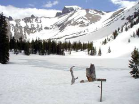 I spent an hour or so this rainy weekend planning for a future trip to Nevada’s Great Basin National Park. (Hang in there, this post is actually about geospatial data and search engine optimization - SEO).
Specifically, I wanted to print out a few areas of the USGS 1:24,000 scale topographic quad maps for the Wheeler Peak portion of the park, which by all accounts includes some delicious spring ski touring terrain.
And as luck would have it, that area of the park falls on the boundary of the Wheeler Peak and Windy Peak USGS quad maps. Ideally, I wanted the plain-jane, collarless, georeferenced files for each map, so I could load them into GIS or an image manipulation app (photoshop, gimp, etc.) and print out just the areas I needed. And, bonus points go to the data stewards if I could do so while avoiding any and all of the following: creating yet another user account, suffering through undesired ads and mouse clicks, downloading additional unneeded bulky data layers, paying fees to resellers of public domain info, and feeling like I was risking infecting my machine with ‘who knows what?’ packed into a download file. Basically, I wanted just the facts, from a trusted, unobtrusive source.