
Nov
21
Contributed by: Nathalie Smith, Esri
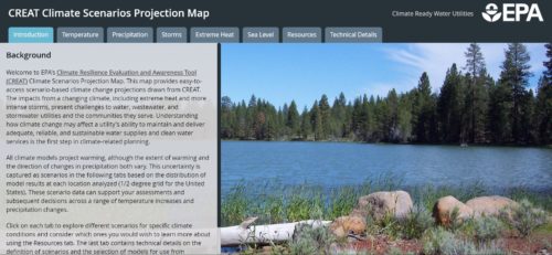
EPA's Climate Resilience Evaluation and Awareness Tool (CREAT) Climate Scenarios Projection Map. This map provides easy-to-access scenario-based climate change projections drawn from CREAT. The impacts from a changing climate, including extreme heat and more intense storms, present challenges to water, wastewater and stormwater utilities and the communities they serve. Understanding how climate change may affect a utility's ability to maintain and deliver adequate, reliable and sustainable water supplies and clean water services is the first step in climate-related planning.
This story map was created with the Story Map Series application in ArcGIS Online.
Share this post: