NSGIC Latest News

Ruminations on Open Geodata Taxonomy (or lack thereof)

Taxonomy (noun) – a scheme of classification  

If you were at the recent Midyear conference, you may recall we had a panel of open data experts fielding questions from the audience. Yours truly asked for the microphone and confessed to being “stuck”, since there seems to be no good way to ensure that all of the various open data sites and platforms and cataloging systems can share catalogs to their content, because they don’t use a common set of terms. This seems analogous to every library using their own unique system to catalog their books. That’s probably how libraries started, but we all know that today there are standards in place that make each library a searchable node in an extensive library network. We lack that today for open geodata. Typical open data sites support searchable metadata and keywords or tags as the method for making data discoverable.  But since any given dataset can be described in an infinite variety of ways, the current situation supports only a limited (and unpredictable) amount of cross-platform catalog sharing. What we need is a common taxonomy.

Just for fun tonight, I tried a few keyword searches on data.gov.  The table below summarizes my results for two popular GIS datasets:

Read More
1 Comments

Geography On the Brain - Spring Break

NSGIC, and spatial thinking in general, are hard habits to break. For those interested in building meaningful state and national digital mapping resources, the camaraderie and synergy of NSGIC conferences, committees, and professional networking is hard to beat.

But, if you’re like me, very occasionally you find yourself engaged in some weird (to others) NSGIC or geography-inspired activity even when trying to get away from it all.

This happened on a road trip to southern Utah and northern Arizona last week. On day 2 of our spring break trip, my family suddenly found ourselves playing a modified version on the license plate game while hiking Zion National Park’s Angels Landing trail with, oh, about 1000 or more of our fellow park goers.

Read More

State Feedback: What I Need Most from NSGIC ...

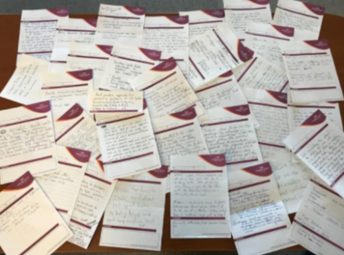
At a State Caucus session during NSGIC’s Annual Conference in Indianapolis last October, we conducted a completely impromptu exercise that produced some interesting, important information. The game was pretty simple. Take one of the ubiquitous hotel notepads and fill in the blank: “What I need most from NSGIC is _______.”

I can’t remember the specifics of what spawned this, but it was time well spent. Here (below) is what we heard. (Thanks to Molly Schar for summarizing the results!)

… help me tap into the collective wisdom of NSGIC members

Read More

Community Resilience Indicators and National-Level Measures: A Draft Interagency Concept | FEMA.gov


Source: Community Resilience Indicators and National-Level Measures: A Draft Interagency Concept | FEMA.gov

White House Office of Management and Budget Releases New Report to Support Community Resilience

On December 21, the White House Office of Management and Budget (OMB) released a new report titled "Standards and Finance to Support Community Resilience," the culmination of collaboration with leaders in re/insurance, catastrophe modeling and building science to advance community resilience and insurability.

The White House: Supporting Resilient Communities: Leaders in the insurance industry are announcing new investments to support resilient communities - Here's Why

NAFSMA Press Release: White House Office of Management and Budget Releases New Report to Support Community Resilience

NENA NG9-1-1 GIS Data Model Available for Public Review

The National Emergency Number Association (NENA) recently released the NENA Standard for Next Generation 9-1-1 (NG9-1-1) GIS Data Model for public review.  Under development for over 6 years, the NG9-1-1 GIS Data Model is designed to support civic location address data management in a NG9-1-1 System. NENA was a major participant in the development of the FGDC’s United States Thoroughfare, Landmark, and Postal Address Data Standard and closely aligned the NG9-1-1 Data Model to the FGDC Standard, but it does have some differences.

The public is invited to review the document and submit comments following the instructions below (direct link https://dev.nena.org/kws/public/document?document_id=9828&wg_abbrev=csds-gis). Comments will be accepted until February 28.

A NSGIC 30-minute webinar about the standard was recently held and is now available on NSGIC’s NG9-1-1 library page (https://www.nsgic.org/next-generation-9-1-1). Those interested in commenting on the document are strongly urged to first review the webinar as it explains what the NG9-1-1 GIS Data Model Standard is, how the document is structured, the GIS data layers needed in a NG9-1-1 system, their structure and use in required NG9-1-1 functional elements, items deferred for future work, how to participate in the public review, and the document’s relationship to other NENA GIS-related standards.

Read More

CREAT Climate Scenarios Projection Map

Contributed by: Nathalie Smith, Esri

EPA's Climate Resilience Evaluation and Awareness Tool (CREAT) Climate Scenarios Projection Map. This map provides easy-to-access scenario-based climate change projections drawn from CREAT. The impacts from a changing climate, including extreme heat and more intense storms, present challenges to water, wastewater and stormwater utilities and the communities they serve. Understanding how climate change may affect a utility's ability to maintain and deliver adequate, reliable and sustainable water supplies and clean water services is the first step in climate-related planning.

Read More