NSGIC Latest News

Prepare: Redistricting Approaches! (and Observations)

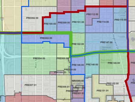
Really big decisions are about to be made in your state. Say what you want about the redistricting process, but the fact is, somebody’s going to have to put the results to work to run our future elections. And with that in mind, I've dusted off my list of observations from 10 years back, about what makes for the best set of boundaries from a standpoint of state election directors, local elections clerks, and GIOs and others supporting them with GIS.

The observations I’m sharing are based on first-hand experience in 2011-12, watching the redistricting process from a safe distance, while preparing to support the use of the new districts. During this period, Utah was one of the first states to integrate GIS-based address locations, voting unit polygons (precincts and sub/splits), aerial photography, and parcel base maps into its statewide elections management system. In addition, the Utah Legislature deployed a 'build-your-own' redistricting plan webmap, another first. As a result, GIS was front and center to the redistricting stage, exposing new users to its power and broadening their appreciation for mapping technology and authoritative data.

Oh, and keep in mind that just to make it more interesting, the Census Bureau is delaying its first 2020 census data product release -- the block-level redistricting files -- by 6 months. With the first glimpses of the 2020 count details not available until at least September 30, we are looking at a compressed redistricting process, and the local and state elections management work to implement new districts, into a few short, but hectic months. [cue up♪GNR’s “Welcome to the Jungle” here♪]

Read More

Transportation Best Practices: On the Road to Success

NSGIC issued Best Practices for State Geospatial Maturity: Transportation today. In addition to being the backbone of our public safety and emergency management infrastructure systems, transportation data have achieved near-ubiquity in the hands of smart device users.

A viable transportation network, particularly a roadway network, is of paramount importance in our society, having the primary purposes of connecting people and places and allowing the movement of people, goods, and vehicles safely and efficiently. Transportation data allow us to spatially model and depict the network for the purposes of planning, asset management, navigation, and routing.

Growing from NSGIC’s 2019 Geospatial Maturity Assessment (GMA), this document is the fourth in a series of best practices collected from “honor roll” states based on individual GMA report cards. Coming soon: cadastre data, hydrography data, elevation data, and orthoimagery data.

Read More

Elevation-Derived Hydrography (EDH) Project Opportunities

Interested in improving your hydrography data using lidar and other elevation data? Then don’t miss any of the following EDH for 3DNHD project opportunities. Each is open to all and NSGIC State Representatives are asked to forward this information to their state NHD/WBD stewards and others with interests in EDH. Non-members will be required to register with the NSGIC website.

EDH for 3DNHD Monthly Forum

NSGIC hosts monthly forums on the third Wednesday of each month at 3:00pm ET. The forums are discussion sessions that feature state, regional, and national EDH activities and resources. The March 17, 2021 forum will feature the USGS EDH Specifications. Register for this and future forums via the ‘Upcoming Events’ calendar at the NSGIC.home page. The January forum featured an introduction to the EDH for 3DNHD project and the February forum featured EDH activities in Michigan. All forums are recorded and published, along with materials, at the NSGIC Learning Link.

EDH for 3DNHD Experience Inventory

A key objective of the EDH for 3DNHD project is to gain a better understanding of how EDH is being implemented at the local level, the motivations for performing EDH, and the EDH challenges and successes experienced. NSGIC has developed the EDH for 3DNHD Experience Inventory to capture specifics about EDH projects and practices. If you have engaged in an EDH project, your information is needed. If you are aware of others that have engaged in EDH, please forward the information. The information gathered from the Forum and the Inventory will be used to identify resources needed to support locally-derived EDH. All contributors should coordinate with their NSGIC State representative prior to completing the survey to ensure that the state representative is aware of the activity and to avoid duplicate responses.

Read More

Sponsor Spotlight: makepath

Equip Your GIS Analysts with Easily Scalable Tools

In this post, makepath will spotlight two tools that are great because they scale well, especially as the scope of a project grows. Scalability is gold in the GIS world.

Xarray-Spatial

Read More

Hennepin County and Mapping Prejudice win Freedom of Information Award

The Minnesota Coalition on Government Information gives a Freedom of Information Award annually. Their focus is on government transparency and efforts to unearth data that make a positive difference. Innovative use of technology is encouraged and rewarded.

The 2021 award will be given to a partnership between Hennepin County and the Mapping Prejudice project for mapping racial covenants recorded between 1910 and 1955. The county scanned and provided all their deeds. It also provided digital cadastral maps to support mapping. The project used optical character recognition (OCR) and thousands of volunteers to find and transcribe racial covenants, then map with GIS.

The product is an animated map showing the spread of racial covenants. The impact has included increased public awareness of the past prejudice and changes in state and local laws to confront that past. Local and national media have reported this story. Jim Crow of the North, developed by Twin Cities public television, has been picked up PBS and soon will be available nationally.

Read More

NSGIC Releases New Guidance for States to Strengthen NG9-1-1 Efforts

NSGIC has published a new guide on Best Practices for State Geospatial Maturity: Next Generation 9-1-1 (NG9-1-1). NG9-1-1 has been a priority for NSGIC for years. This best practices document is a collection of insights from states further along in adoption and planning of NG9-1-1 efforts.

Next Generation 9-1-1 is a gamechanger for the 9-1-1 community. It utilizes GIS technology to deliver every 9-1-1 call - mobile, VOIP, and landline alike - to 9-1-1 public safety answering point (PSAP) centers with precise geographic coordinates.

With the implementation of NG9-1-1, it is possible for the 9-1-1 network to process text messages, photos, and videos in addition to voice through a faster and more resilient system. NG9-1-1 will also support PSAPs in cases of call overload and natural disasters, and jurisdictional issues.

Read More

What Makes for Strong Statewise GIS Coordination? High Performing States Weigh In

Strong statewide GIS coordination is good government. It:

  • Reduces duplication of efforts
  • Builds and maintains foundational data layers
  • Ensures access to public data
  • Leverages economies of scale for products, software, and services
  • Augments the knowledge base of professionals in the field
  • Establishes standards and best practices through collaborative processes

In short, it supports efficiency, integration, and smart decision-making.

Last week, NSGIC published Best Practices for State Geospatial Maturity: Coordination.

Read More

NSGIC Announces New Board Members; New York State’s Frank Winters takes over as President

National States Geographic Information Council (NSGIC) announces the appointment of five new members to its Board of Directors, as well as the full slate of officers and board members for the 2020 - 2021 term.

Frank Winters (NY) makes the move from President-Elect to assume the presidency of NSGIC, taking the reins from Karen Rogers (WY). Frank is the Executive Director of the New York State Geospatial Advisory Committee. Frank has a Master of Science in Geography from the University of Idaho and has been involved with GIS in New York State government for 29 years.

“The COVID-19 pandemic has created new grand challenges for our nation and highlighted the need for continued coordination of and investment in our geospatial data, technologies, and workforce,” said new NSGIC President Frank Winters. “I am thrilled to have the opportunity to serve our NSGIC family as president. I am confident that the nation’s geospatial community will play an even more impactful role in the challenges that lie ahead.”

Jenna Leveille (AZ) has been elected President-Elect to the 2020-21 Board of Directors. An Oregon State University graduate, and Arizona State Land Department (ASLD) employee of twelve years, Jenna has more than 15 years of GIS experience. She is currently a Senior GIS Analyst and project leader for the Arizona State Land Department. Jenna has served as the Arizona State Representative to NSGIC since 2017.

Read More

2020 Geospatial Excellence Awards Announced

Eight Awards Presented at NSGIC Virtual Annual Conference

National States Geographic Information Council (NSGIC) President Karen Rogers (WY) led a celebration of the 2020 Geospatial Excellence Awards during an online reception held this evening in conjunction with the organization’s Virtual Annual Conference.

2020 Geospatial Excellence Awards:

  • Catalyst Awards: for extraordinary effort and/or results in getting things done:
    • AZGeo Geospatial Data Hub
    • King County Information Technology – GIS for Equity & Social Justice Team
    • MassGIS NextGen 9-1-1 Team
    • Minnesota’s Mapping Prejudice Project
    • State of California - GIS
    • Vermont’s Statewide Property Parcel Mapping Project
  • Innovator Award: for creatively advancing geospatial technical capabilities or problem solving
    • Elizabeth Curley
  • Champion Award: for leadership and support, often at an executive level
    • Dennis Pedersen

“The awards are testimony to the dedicated professionals doing amazing work in states across the country,” says NSGIC President Karen Rogers. “Every recipient is providing value to their GIS community or tools to inform decision makers, which is what it’s all about. The benefits NSGIC members bring to their constituents and leadership cannot be understated, not to mention pushing the envelope of innovation when it comes to location intelligence and data science. It fills me with pride to know how the technology we care so deeply about makes such a difference.”

Read More

Partner Spotlight: GeoComm

Accurate GIS data is important throughout 9-1-1 emergency response and has a critical role in NG9-1-1 by determining which Public Safety Answering Point (PSAP) to route a 9-1-1 call to. This process of geospatial call routing enables better accuracy than traditional 9-1-1 systems and can reduce the number of 9-1-1 calls transferred due to misrouted 9-1-1 calls.

For the last 25 years, GeoComm has been working to help GIS and 9-1-1 teams across the country understand the role GIS plays in 9-1-1 and NG9-1-1, empowering them to achieve public safety grade GIS. Our assess, improve, and maintain proven process tackles the common obstacles agencies face when working to implement an NG9-1-1 system. Because the NG9-1-1 services utilized in this approach are simple and straightforward, they are easily adaptable for jurisdictions of all sizes including local, regional, and statewide.

Read More

Partner Spotlight: Fugro

Shining a Light on Change with Recurring Lidar Programs

Our landscape is in a state of constant change. Cities and towns are expanding at a rapid pace, while natural disasters are rearranging rivers, eroding shorelines, and crumbling infrastructure. To effectively manage change, we need geospatial data that is both fit-for-purpose and recurrent, as well as visualization tools to communicate this information to a wide range of stakeholders.

The Value of Recurrent Lidar Data

Read More

First County - Maricopa, Arizona - Shares Lessons Learned From Geo-Enabling Elections

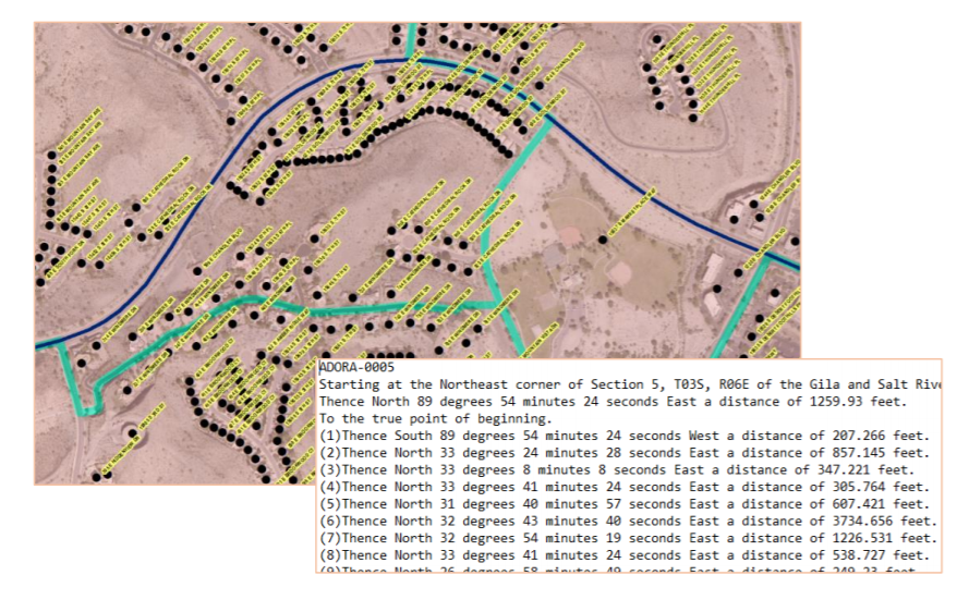
Maricopa County, Arizona, was focused on data accuracy and data management efficiency when work started to geo-enable their elections. This is understandable; the county, which envelopes one of the fastest-growing metropolitan areas in the United States, Phoenix-Mesa-Scottsdale, was seeing many of the challenges of rapid growth first-hand, including new residential areas, the annexation of land by cities, and the addition of many new voters.

Those efficiency benefits have been realized, in spades, now, some 15 years later. To give one example: changing the old, tabular records to reflect new district boundaries – as happens during redistricting – could take hundreds of hours. Now, changing one boundary to a different one can be done in minutes. Similarly, a legal description for a new voting district can also be created in minutes.

Read More

New Guidance Issued for States to Strengthen Address Data Programs

Complete & Accurate Data Necessary for Emergency Response, Other Government Services

A report issued today by the National States Geographic Information Council (NSGIC) targets a key dataset for state governments. “Best Practices for State Geospatial Maturity: Addresses” is available now.

“Addresses are created by local address authorities in city, county, and tribal agencies,” explains NSGIC Executive Director Molly Schar. “The data support delivery of services like utilities and emergency response, so getting it right is absolutely critical. NSGIC advocates the process of rolling up local address point records to the state to aggregate and then to the national level to save lives, reduce costs, avoid duplication, increase revenues, improve service, and foster efficient and effective government.”

Read More

Partner Spotlight: Hexagon

The Importance of Geospatial Data Intelligence in Times of a Global Pandemic

As the COVID-19 global pandemic keeps the world on edge and uncertainty has sparked historical volatility in the global markets, there has been ample opportunity to reflect on how location intelligence data can aid reaction, response, and recovery in this unprecedented scenario.

Government customers of Hexagon’s Geospatial division have used its M.App Enterprise platform to develop and implement dynamic monitoring systems to close the gap between location information and critical operations. These maps and dashboards are empowering officials and citizens to make informed decisions about procuring essential items, tracking local infection rates, proposing countermeasures, and communicating the most effective ways to stay safe.

Read More

State Spotlight: Indiana

Megan Compton
Indiana Geographic Information Officer, Indiana Geographic Information Office

Interviewed by Robert C. Hoyler

“One challenge we have created is talking too much about GIS, from a technical aspect versus telling the story to better stimulate participation and success. How do we get there? The GIS topic can be overwhelming, so we need to put discussions in a recognizable format and relatable story to achieve a broader project to open the door. I’d like to challenge myself, or anyone, to a meeting and not say “map” or “GIS” - I think it would be difficult,” says Megan Compton, Indiana state Geographic Information Officer (GIO).

Compton became the GIO of Indiana in 2018 and attended her first NSGIC conference in Kentucky the same year. “The first conference was eye opening – I was still relatively green in my job and almost immediately found the NSGIC membership to be all people I have been looking for, who share the understanding of what I’m involved with. With this group, I can step into a conversation without having to explain the background,” says Compton. Learning about opportunities to support advocacy and lead at the national level has helped her implement growth in her own organization.


Read More

State Spotlight: Alabama

Phillip Henderson
State of Alabama GIO, Alabama Law Enforcement Agency (ALEA) / Director of the Alabama Geographic Information Office (AGIO)

Interviewed by Robert C. Hoyler

For the last 30 years, Alabama State GIO Phillip Henderson has worked in state government with much of that time spent working in the field of GIS. He was appointed as the Geographic Information Officer (GIO) for the State of Alabama by Governor Bentley in September 2014 and the Director of the Alabama Geographic Information Program Office in June 2011. He also serves as the Director for Virtual Alabama at the Alabama Law Enforcement Agency (ALEA).

“It was truly significant to see the establishment of the state GIS office in 2011 and to see the creation of a GIO position in 2014’” reflected Henderson.


Read More

A Closer Look at Geospatial Maturity Assessment Disconnects

The initial 2019 Geospatial Maturity Report (GMA) report was just that - initial. Like geologic stratigraphy, the more you dig into it, the more complex information you can find and understand about the layers above. I have been digging into the report findings to do just that, and as expected there’s a lot more to the story.

The inspiration for the GMA report card was the national report card produced by the Coalition of Geospatial Organizations (COGO). A logical step is to take a look at how these evaluations compare. I was curious as to the consistency of the grades between the two. Through the GMA process, we determined that about half of the framework themes are led by the federal government, while the other half are led by state and local data stewardship efforts. While most of them are in general alignment, of the federal-led themes, two stick out as having a serious disconnect between the grades.

Geodetic Control and Governmental Units both received an A- nationally, while state grades don’t fare nearly as well. While the National Geodetic Survey (NGS) does a great job maintaining and improving a national geodetic control system, not many states are doing much to improve above and beyond the federal data and program. While the theme is poorly understood, it is important for states in the public land survey system (PLSS) to accurately map private property in those states. The grade disparity suggests an overconfidence in the extent and reaches of the federal program and its ability to serve state needs.

Read More

Joint Statement on the Value of GIS in the Pandemic

The spread and effects of COVID-19 can be best understood considering space and time.

As governments are responding to COVID-19, more leaders are recognizing the value of “knowing the where.” The importance of knowing where the outbreak is growing, where high-risk populations are, where the hospital beds and important medical resources are, and where to deploy resources is essential. “Knowing the where” informs better decision-making.

In an effort to better understand the where, governments are recognizing the value of geospatial information and technologies and are engaging geospatial professionals to help them better understand the where to help them in their decision-making and response. Geospatial professionals bring unique analytical and visualization skills to the table that help responders and decision-makers visualize where the pandemic is spreading more quickly and can make the important decisions regarding where response and resource needs need to be focused. The value of telling the story through a map coupled with a geospatial dashboard provides a view of the event not readily seen in a table such as a spreadsheet. Beyond visualizing existing data, we can connect data from a location perspective, which enhances the value of the data sources being integrated. Equally important in this event is data on COVID-19 cases and testing packaged and shared in a way useful to scientists.

GIS (geographic information systems) is experiencing an unprecedented level of use. Historically, GIS was deployed following a disaster to help respond and recover. Today, GIS is used as a disaster is unfolding. The COVID-19 event is an outstanding example of how effective GIS is when robust data is available. Governments are realizing the value of investing in these systems and the people who run them.

Read More

State Spotlight: Mississippi

Jim Steil
Director, MARIS (Mississippi Automated Resource Information System)

Interviewed by Scott Bennett

MARIS Director Jim Steil has been working in GIS for 26 years and in his current position for 16 years. Steil got his start in cartography from the earlier days of Mylar and technical pens and later on took a GIS class to create maps of his thesis area. He hasn’t looked back.

Steil says that over the past 20 years, he has seen the change from a few pockets of GIS activity and no real internet access to an incredible web-centric cluster of activities that he could only have dreamed of in the 90’s. Newer generations, he says, see even greater value in the technology. He also reflected on the change of GIS coordination efforts over the years - from purely technical get-togethers to the integration of policy/decision-makers as the main focus.


Read More

Partner Spotlight: Dewberry

Power of Partnerships: Standardizing and Streamlining Preliminary Damage Assessments

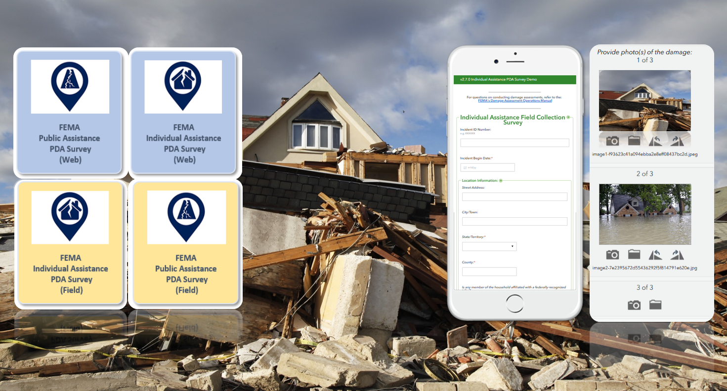
In 2019, there were 100 major presidentially declared disasters in the U.S. providing recovery assistance to 39 affected states and territories. In order to obtain a presidential declaration, a governor or tribal chief must submit a request to their Federal Emergency Management Agency (FEMA) regional office for assistance. This request includes preliminary damage assessment (PDA) information to document the extent of the disaster and its impact on individuals and public facilities. PDA information is used to show that the disaster is of such severity and magnitude that supplemental federal assistance is necessary for response and recovery efforts. For severe or catastrophic events, a governor or tribal chief may submit a declaration request prior to performing a PDA.

At Dewberry, we understand that dealing with the aftermath of a disaster is a stressful and trying time. Documenting damages can take time and resources that are better spent focusing on response and recovery efforts. Disasters are increasing in frequency and severity, therefore a streamlined approach to documenting damages makes the process of submitting declaration requests faster—facilitating an expedited recovery process. In partnership with ArdentMC, Dewberry supports FEMA, states, territories, and local agencies to help better quantify and quickly assess damage in an effort to expedite needed aid to impacted communities. We are now helping to facilitate and simplify the PDA process in an effort to decrease assistance timelines. Under this contract work with FEMA, the team is providing subject matter and technical expertise to help standardize collection of incident reported damage assessments in impacted areas using newly designed Esri Survey123 templates. These templates use GIS technology to electronically collect, submit, and validate damage assessment in a standardized and sharable way. The platform being used to manage the data collection is hosted in an Amazon Web Services (AWS) GovCloud region and is accredited by the Department of Homeland Security (DHS). Utilizing ArdentMC’s AWS competency in public safety and disaster response, coupled with Dewberry’s gold partnership with Esri, the PDA team has created a highly scalable collection platform for FEMA’s damage assessment mission.

Read More