First County - Maricopa, Arizona - Shares Lessons Learned From Geo-Enabling Elections
July 14, 2020
Maricopa County, Arizona, was focused on data accuracy and data management efficiency when work started to geo-enable their elections. This is understandable; the county, which envelopes one of the fastest-growing metropolitan areas in the United States, Phoenix-Mesa-Scottsdale, was seeing many of the challenges of rapid growth first-hand, including new residential areas, the annexation of land by cities, and the addition of many new voters.
Those efficiency benefits have been realized, in spades, now, some 15 years later. To give one example: changing the old, tabular records to reflect new district boundaries – as happens during redistricting – could take hundreds of hours. Now, changing one boundary to a different one can be done in minutes. Similarly, a legal description for a new voting district can also be created in minutes.
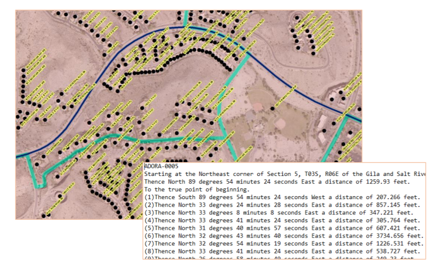
“Changing the cyan boundaries to the navy boundaries in this image takes minutes in the GIS.” - Gary Bilotta, Director of IT & GIS at Maricopa County Recorder’s Office.
Address and voter list accuracy have also improved, leading to fewer wasted resources and increased voter confidence. Today, anyone can view visually how a voter in a certain location is accurately placed within a number of different voting districts.
What the county didn’t perhaps foresee were all the ancillary benefits. Today, using insights about past voter behavior, the county can provide voter services locations where they are most needed, and it can use spatial tools to manage issues on election day. In addition, a testament to the data quality excellence now in place in Maricopa county is offered by the number of other tasks the data is being deployed for: school districts use it to route school buses, Blue Stake, an organization that identifies underground utility lines, reference it, and both the regional and state 911 organizations leverage it.
This is not to say that fully integrating GIS into the county’s elections management, including the voter registration system, was easy. The county used significant resources and generated some valuable learnings, including the importance of planning, and of preparing people for change – specifically, ensuring that everyone involved is comfortable speaking about the change and why it is happening. This learning echoes one noted in other case studies, and highlighted in NSGIC’s Best Practice Guidance – Improving America’s Elections with GIS, Best Practice no. 1, Convene a Team of Specialists.
To read the full case study about how Maricopa County, Arizona, geo-enabled their elections, and what they are still doing today to further enhance their data, follow this link.
To download a copy of NSGIC’s Best Practice Guidance, please go to elections.NSGIC.org.
Questions? Contact Jamie Chesser, NSGIC director of programs at [email protected].
|

