Filtered by category: GIS in States Clear Filter

State Spotlight: Kentucky

Kent Anness
GIS Manager, Kentucky Office of Technology

Interviewed by Sheila Steffenson

Kentucky GIS Manager Kent Anness has been working in GIS for 30 years and state government for 20 years. Anness got his start in cartography and initially used a scribe tool and darkroom methods for producing map compilations.

Anness says that over the past 20 years, not only has the technology grown, but the accessibility of enterprise GIS has grown as well, allowing for an increased number of users within state government. According to Anness, newer generations see even greater value in the technology.


Read More

State Spotlight: New Jersey

Andy Rowan
Geographic Information Officer, NJ Office of Information Technology

Interviewed by Sheila Steffenson

New Jersey Geographic Information Officer Andy Rowan says that after 13 years in state government, “the biggest challenge remains a gap in awareness outside of the state’s GIS community regarding the capabilities of GIS technology.” Awareness and education can be obstacles in taking any state GIS program to the next level.

Rowan’s career in GIS started when he was a junior staff member at a small environmental consulting firm. When one of the firm’s senior scientists became convinced GIS should be brought in, earth scientist Rowan -- with the most bandwidth -- was tapped to take it on. The firm sent him to training and he never looked back.


Read More

State Spotlight: Massachusetts

Neil MacGaffey
Director, MassGIS

Interviewed by Sheila Steffenson

In his 18 years of working in state government, Massachusetts’ GIS Director Neil MacGaffey said he has seen the “steady push to a larger and larger scale of mapping. Resolution of all data has improved. Statewide mapping of parcels, addresses, and structures now exists and is a game changer.”


Read More

Information Sharing & Priority Setting: The Rhythm of State GIS Coordination

For state Geospatial Information Officers and statewide GIS coordinators, engaging with GIS leaders is one of the biggest parts of the job. The most common mechanism is regular meetings with state agency GIS leaders, although the frequency and formality vary greatly by state.

Frank Winters, New York GIO, noted, “New York has a Geospatial Advisory Council which meets quarterly. The council has representations from every sector but is intentionally weighted to local governments. Since New York has centralized IT support, much of the engagement with agencies is done through normal IT governance.”

“In Vermont, we meet monthly. We have a charter signed by agency secretaries and we have annual business plans,” said John Adams, Director for the Vermont Center for Geographic Information. “The group includes 11 voting representatives from different agencies/departments, with more people attending depending on the agenda. Standards and policies are primarily worked out by subgroups. For the past year, we’ve been having ‘GeoEnlightenment’ sessions an hour before each meeting, which typically involves a guest speaker. These have been well received.”

Read More

State Spotlight: Utah

Matt Peters
Automated Geographic Reference Center Director

Interviewed by Tim Bohn

For Utah GIO Matt Peters, successful statewide GIS coordination is all about communicating a vision and helping everyone speak the same language. It takes strategy and finesse, he said, to “make sure the tide raises all boats.”

Helping stakeholders embrace that vision means focusing on the data rather than getting caught up in the technology. “Data is the foundation and is fundamental to analysis,” he said. “For example, address ranges affect geocoding, so if the quality is not there, nothing moves forward. Today … improved, polished data [is available] for use in web services. Point-in-polygon matching is also more accurate.”


Read More

State Spotlight: Florida

Ekaterina Fitos
State Geospatial Information Officer

Interviewed by Tim Bohn

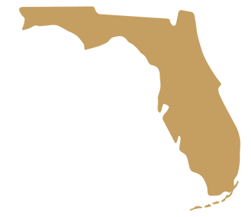
Florida is a big, complex state, said GIO Ekaterina Fitos, and the key to coordinating GIS across the state is through a collaborative enterprise approach with GIS focused work groups and engagement of stakeholders.

Just ten months into the job as Florida’s first GIO, Fitos said she is continuing to assess Florida’s statewide spatial data infrastructure. There are plenty of success stories, she said, citing the Florida Department of Environmental Protection’s mobile applications one of which assists with notifying the public about state park closures during disasters (Figure 1), the GATOR web application by the Florida Division of Emergency Management (FDEM) (Figure 2), and an online system to monitor sea turtles developed by the Florida Fish and Wildlife Commission (FWC) (Figure 3) .


Read More

State Spotlight: Minnesota

Dan Ross
GIO, Chief Business Technical Officer and CIO, Pollution Control

Interviewed by Tim Bohn and Tim Donze

Minnesota GIO Dan Ross has spent 23 years in state government if you include the three years he spent as a system administrator and adjunct professor teaching GIS at St. Cloud State. In that time, he has seen GIS go from highly collaborative to falling off, and now in resurgence with both data sharing and a standards development.

Five years ago, said Ross, there were no statewide parcels, centerlines with address ranges, addresses or standards to support those data layers. The state “is in much better shape now,” he said. “The community has come together and renewed the collaboration.”


Read More

New Podcast Explores Role of GIS in Government


In a new collaboration, NSGIC and StateScoop have launched GIS Addressed to feature the perspectives of state government GIS experts on key issues. The series connects the dots between how geographic information systems work, why they are important, and how they fit into government technology agency operations and initiatives.

"Geographic information systems have been a part of the fabric of government for decades. Now, in an era of increased focus on the centralization of technology and on information technology agencies within state and local government, a new day is here for GIS. And it could completely change how technology, data, mapping and more function in government," says Associate Publisher and Director of Strategic Initiatives at StateScoop, Jake Williams.

Read More

Kim Cloud Receives Delaware Award for Excellence and Commitment in State Service

Major kudos to NSGIC member Kim Cloud, who received the Delaware Award for Excellence and Commitment in State Service for her work with geographic information systems (GIS) at the Delaware Governor’s Awards Ceremony on May 7, 2018. The award is a statewide recognition given to five State of Delaware employees, or groups of employees, who exemplify the highest standards of excellence and commitment in state service.

kim cloud geospatial service award delawareThe Department of Technology and Information (DTI) nominated Kim Cloud for the Delaware Award for Excellence and Commitment in State Service because of her outstanding state service and ongoing commitment to DTI. Kim has worked at DTI since July 19, 2004, and has spent her tenure as a software engineer for the Application Delivery team. Kim’s passion is working with geospatial data (location-based data) and GIS software and tools, i.e. FirstMap, which is a GIS solution that provides a centralized repository and enables users to maintain and analyze spatial data.
Kim’s dedication to GIS excellence in the state is not limited to her work at DTI. She received her Geographic Information Systems Professional Certification from the GIS Certification Institute in December 2011 and is a member of the Delaware Geographic Data Committee and the National States Geographic Information Council. Additionally, Kim is an adjunct faculty member at Wilmington University and teaches an Applied Geographic Systems course.

Read More

Value of a GIO

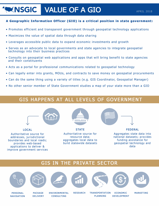
Having spent a dozen years in the role of state GIO, I have thought a lot about the importance of that work. We in government GIS often talk in terms like “coordination,” and certainly coordination and governance is the core of what a GIO does. But why is it so much more important in GIS than in other subdisciplines of IT? The rest of the data world is catching on, with the (fairly recent) advent of chief data officers. But we in GIS have been talking about and working on those issues for as long as I’ve been in the field.

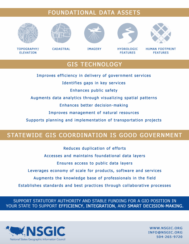
What’s so special about spatial? I think it comes down to a simple fact. The great majority of the financial investment required to get a GIS initiative to the finish line goes into data that is not specific to the project. That’s really not true in other data-intensive disciplines. It was especially true in the early days, but foundational data continues to be a substantial investment. The data that it takes to make a plain old base map adds up to a big cost. And everybody doing GIS needs that same base map data. So it has always been obvious to anyone without unlimited funds that they’re better off sharing that cost. And that only happens through coordination.

GIOGIO

We probably could do a better job selling the importance of that concept outside of the GIS world. And the term that rings the right bells is cost avoidance. GIS coordination saves money, and lots of it, by preventing duplication of efforts. In the absence of GIS coordination, everyone who needs the foundational data would either build it themselves or buy it from a commercial source. That could mean the quality of the data might be inferior and it would certainly be more costly. The return on investment for collaborative GIS is exponential.

Read More

Enhancing the Arizona Address Data Management Ecosystem: Midyear Meeting Presentation Highlight

With our Midyear Meeting fast approaching, we wanted to slow down and take a moment to highlight some of the presentations and panels that we are looking forward to. This week we are highlighting a presentation titled “Enhancing the Arizona Address Data Management Ecosystem," presented by Jenna Straface, Gene Trobia, Bo Guo, and Howard Ward on Tuesday, February 27. Read Jenna's presentation description below for a preview of the discussion content:

As one of the two original pilot states for the National Address Database (NAD) project, Arizona continues to build a statewide address management ecosystem. Key success factors include support of the Arizona Geographic Information Council (AGIC) and the Arizona State Land Department (ASLD), active state and local government collaboration, strategic public and private partnerships, participation in NSGIC's Address & Transportation Committee’s identification of national guidelines and best practices, and the adoption of new technology to improve data workflows and validate authoritative addresses.

The presenters will provide a brief overview of the Arizona Address Management Ecosystem and discuss several of its key components:

Read More

GIS in Computer Science Education: Midyear Meeting Panel Highlight

With our Midyear Meeting fast approaching, we wanted to slow down and take a moment to highlight some of the presentations and panels that we are looking forward to. The first panel we are highlighting is titled “GIS in Computer Science Education” and will be presented by Karen Rogers (WY) on Thursday, March 1. Read Karen’s statement below for a preview of the discussion content:

I was asked to be on the Computer Science Education Task Force in Wyoming, an effort led by the Department of Education. This diverse group has been meeting since September of 2017 to formulate strategies and ideas for integrating computer science (CS) in the classroom, as well as encouraging elected officials to pass legislation to formally acknowledge the importance of CS being taught to all grades in all schools.

Part of the discussion has centered on teaching computational thinking and the foundation of CS starting in elementary school so that all students have a basic fluency in CS by the time they enter middle school. From there, similar to electives like band or art, students can expand their learning and literacy in the subject and begin to specialize in the areas they find most interesting.

Read More

NSGIC - State GIS Council Partnership

A goal of mine, a few years back during my first year as AGRC's director was to facilitate increased 'enterprise GIS' interest and involvement of our state GIS association, the Utah Geographic Information Council (UGIC), a standalone 501c3 nonprofit.

One of the coolest things about professionals in the GIS field is that most of us value strategic problem solving approaches that reach beyond the domains of our individual assignments or agency responsibilities. GIS'ers have a strong tendency to look out for the 'whole' where others might not. While everybody in our field knows the vast degree to which the ‘enterprise of GIS’ in Utah is dependent on data sharing -- especially local to state government -- it is largely undersung to decision makers. Getting UGIC more interested in telling this story well seemed like a natural fit.

So for the goal of working more with UGIC, I didn't feel like anybody needed much persuasion. Rather, it was about making it easier to connect and participate. And to make that easier, we started by upgrading from individual-level NSGIC membership to the State Leaders 5-person membership package. By doing so, we added 4 Utah members, a mix of other state agency GIS managers and UGIC Board members who are elected to their positions specifically to represent the state, county, local, business, and academic sectors.

Read More

State Feedback: What I Need Most from NSGIC ...

At a State Caucus session during NSGIC’s Annual Conference in Indianapolis last October, we conducted a completely impromptu exercise that produced some interesting, important information. The game was pretty simple. Take one of the ubiquitous hotel notepads and fill in the blank: “What I need most from NSGIC is _______.”

I can’t remember the specifics of what spawned this, but it was time well spent. Here (below) is what we heard. (Thanks to Molly Schar for summarizing the results!)

… help me tap into the collective wisdom of NSGIC members

Read More