NSGIC Latest News

'Imagery for the Nation' as Timely as Ever

Aerial photography is an incredibly valuable resource to a broad set of uses in the business, government, and research sectors. An aerial view, whether from a satellite or an airborne camera, provides excellent situational awareness, for among other things:

  • Responding to a crisis - like 911 centers coordinating response to everyday emergencies or coordination for wildfires, flooding, and hurricanes
  • Informing real-time consumer decisions and organizational operations - everything from tourism to package delivery
  • Planning for the future - like siting and designing new developments and transportation projects
  • Building map-based datasets of infrastructure and natural assets - to better inventory and analyze how urban and natural systems perform
  • Providing a historical record over time - for dispute resolution and understanding development and change patterns

While it is expensive to acquire, it is practically indisputable that the immense value of accessible, up-to-date, and high-resolution aerial photography dwarfs the costs to capture and distribute the imagery.

So what's the problem? In a nutshell, there's no national model in place to efficiently fund, collect, and provide access to this highly desirable resource, that - unlike most types of products - actually becomes more valuable the more it is put to use.

Read More

Homeland Security Study Focusing on GIS Infrastructure for Disasters

On NSGIC’s behalf, I recently attended the second workshop of the DHS Disasters Interoperability Concept Development Study being conducted by the Open Geospatial Consortium (OGC).

This workshop follows the announcement that the Department of Commerce Economic Development Administration has $587 million in FY18 supplemental appropriations available for disaster recovery grants.

For the concept development study, OCG is bringing together key stakeholders in the natural hazards disaster communities to assess the current state of data and product exchange technologies used in disaster planning, response, and recovery. The results will aid in developing a series of pilots to advance the state of spatial data infrastructures that support global disaster risk reduction.

Read More

Pilot Project Kicks Off for 3DEP for the Nation Initiative

Seven states will be testing the state lidar acquisition planning guide developed by NSGIC as part of the 3DEP for the Nation collaboration with the USGS National Map 3D Elevation Program and the Federal Geographic Data Committee 3DEP Working Group. Iowa, Illinois, Montana, Ohio, Tennessee, Washington, and Wisconsin will receive a draft of the guide to put into action and report monthly on what worked, what’s insufficient, what’s missing, and which external resources should be referenced. This information will help to refine the guide, which is due to be completed for NSGIC membership use and comment as early as February 2019.

3DEP for the Nation addresses the need for high-quality topographic data and three-dimensional representations of the nation’s natural and constructed features. Believing 3DEP coverage across the US can be most effectively achieved by establishing plans for each individual state and territory, NSGIC is leveraging its strong working relationships with state geospatial information officers and coordinators to develop these plans.
Read More

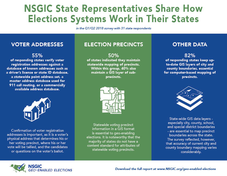
NSGIC State Representatives Share How Elections Systems Work in Their States

NSGIC state reps survey geo-enabled elections

More than two-thirds of states responded to a nationwide survey on elections data conducted in the first half of 2018. Responses were coordinated by state government representatives who focus on the development and deployment of mapping data and systems across state agencies and local governments.

Read More

New Podcast Explores Role of GIS in Government


In a new collaboration, NSGIC and StateScoop have launched GIS Addressed to feature the perspectives of state government GIS experts on key issues. The series connects the dots between how geographic information systems work, why they are important, and how they fit into government technology agency operations and initiatives.

"Geographic information systems have been a part of the fabric of government for decades. Now, in an era of increased focus on the centralization of technology and on information technology agencies within state and local government, a new day is here for GIS. And it could completely change how technology, data, mapping and more function in government," says Associate Publisher and Director of Strategic Initiatives at StateScoop, Jake Williams.

Read More

Kim Cloud Receives Delaware Award for Excellence and Commitment in State Service

Major kudos to NSGIC member Kim Cloud, who received the Delaware Award for Excellence and Commitment in State Service for her work with geographic information systems (GIS) at the Delaware Governor’s Awards Ceremony on May 7, 2018. The award is a statewide recognition given to five State of Delaware employees, or groups of employees, who exemplify the highest standards of excellence and commitment in state service.

kim cloud geospatial service award delawareThe Department of Technology and Information (DTI) nominated Kim Cloud for the Delaware Award for Excellence and Commitment in State Service because of her outstanding state service and ongoing commitment to DTI. Kim has worked at DTI since July 19, 2004, and has spent her tenure as a software engineer for the Application Delivery team. Kim’s passion is working with geospatial data (location-based data) and GIS software and tools, i.e. FirstMap, which is a GIS solution that provides a centralized repository and enables users to maintain and analyze spatial data.
Kim’s dedication to GIS excellence in the state is not limited to her work at DTI. She received her Geographic Information Systems Professional Certification from the GIS Certification Institute in December 2011 and is a member of the Delaware Geographic Data Committee and the National States Geographic Information Council. Additionally, Kim is an adjunct faculty member at Wilmington University and teaches an Applied Geographic Systems course.

Read More

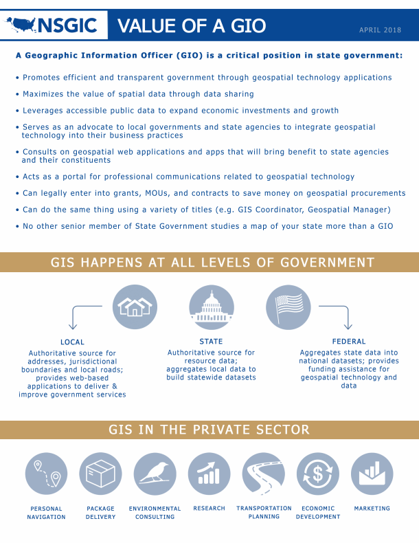
Value of a GIO

Having spent a dozen years in the role of state GIO, I have thought a lot about the importance of that work. We in government GIS often talk in terms like “coordination,” and certainly coordination and governance is the core of what a GIO does. But why is it so much more important in GIS than in other subdisciplines of IT? The rest of the data world is catching on, with the (fairly recent) advent of chief data officers. But we in GIS have been talking about and working on those issues for as long as I’ve been in the field.

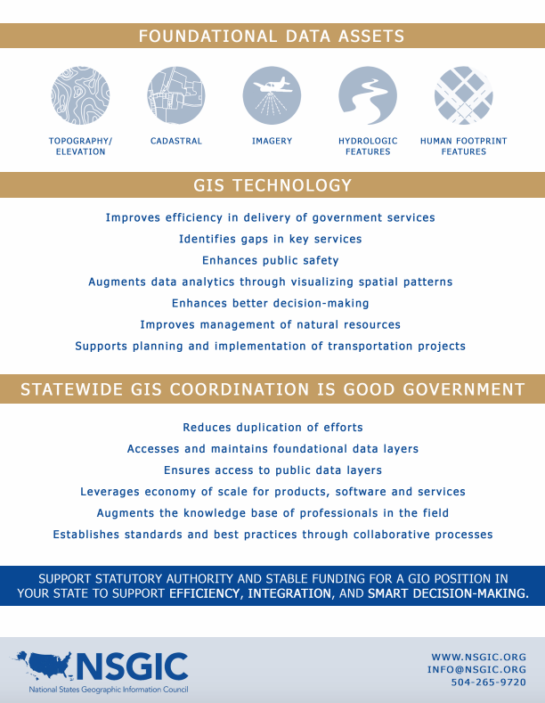
What’s so special about spatial? I think it comes down to a simple fact. The great majority of the financial investment required to get a GIS initiative to the finish line goes into data that is not specific to the project. That’s really not true in other data-intensive disciplines. It was especially true in the early days, but foundational data continues to be a substantial investment. The data that it takes to make a plain old base map adds up to a big cost. And everybody doing GIS needs that same base map data. So it has always been obvious to anyone without unlimited funds that they’re better off sharing that cost. And that only happens through coordination.

GIOGIO

We probably could do a better job selling the importance of that concept outside of the GIS world. And the term that rings the right bells is cost avoidance. GIS coordination saves money, and lots of it, by preventing duplication of efforts. In the absence of GIS coordination, everyone who needs the foundational data would either build it themselves or buy it from a commercial source. That could mean the quality of the data might be inferior and it would certainly be more costly. The return on investment for collaborative GIS is exponential.

Read More

Federal Agencies Support State Lidar Plans in “3DEP for the Nation” Project

NSGIC’s participation in the recent USGS 3DEP Working Group meeting gave us a chance to connect with NRCS, USGS, FEMA, NOAA, USFWS, USACE, USDA FS, and other federal agencies to discuss a strategy for completing national lidar coverage by 2023. (Acronyms translated below.) Coordination with and within US states and territories is a key component of this strategy and NSGIC, with a grant from USGS, is taking the lead on that coordination.

The meeting discussion included the benefits of interagency cooperation and methods for leveraging federal and state resources toward the efficient and effective capture of lidar. Coordination issues of concern included variations in:

  • Mission specific needs, for example, leaf on/off
  • Quality level
  • Budget schedules
  • Geographic units of capture and delivery
  • Centralized vs decentralized agency planning structures

The agencies discussed the value of state plans to provide information about priorities for lidar acquisition and to identify key stakeholders. More importantly, they recognized the planning efforts as a means for states to self-organize with regard to lidar; to establish a community and process that can vet stakeholder lidar data acquisition needs, outline schedules and budgets, and identify and solicit funding. The creation of a state plan template was seen as a means to construct the information in a manner that could support:

Read More

Support for Geospatial Data Act More Critical Than Ever

In the last Congress - the 114th - some 9,600 bills were introduced. Less than 4% of them were signed into law. These are daunting numbers when you are pushing for a piece of legislation that you think is important enough to make it to the finish line. NSGIC has encouraged members of our community to support the Geospatial Data Act (S.2128 and H.R.4395) from the start, but that support has never been as critical as it is right now.

On a conference call with other member of the Coalition of Geospatial Organizations (COGO) this week, there was significant discussion about some of the issues standing in the way of unanimous support. Several organizations (NSGIC included) have been working to develop language palatable to associations with vastly different memberships. Folks in the open data/open government community have expressed concern about language around proprietary or licensed data being available on the GeoPlatform. Still others are caught up in a desire to include language related to licensure and procurement. Neither of these issues is appropriate to try to resolve in this bill. It should be noted, however, that the Geospatial Data Act is fundamentally an open data bill.

The irony is that without exception (to my knowledge, anyway), the geospatial community can agree that what the Geospatial Data Act is trying to accomplish is a good thing. The legislation codifies existing executive orders and other guidance documents that direct the work of the Federal Geographic Data Committee (FGDC), the body that promotes national coordination in developing, using, sharing and disseminating geospatial data. It gives the FGDC the authority to make federal agencies follow some existing common sense rules and provides Congressional oversight over the geospatial activities of FGDC members and other agencies. It provides a great deal more clout to input developed by the multi-sector membership of FGDC’s National Geospatial Advisory Committee. And very importantly to NSGIC, it requires federal agencies to coordinate and work in partnership with other federal agencies, agencies of state, tribal, and local governments, institutions of higher education, and the private sector with the collective goal of achieving a robust national spatial data infrastructure.

Read More

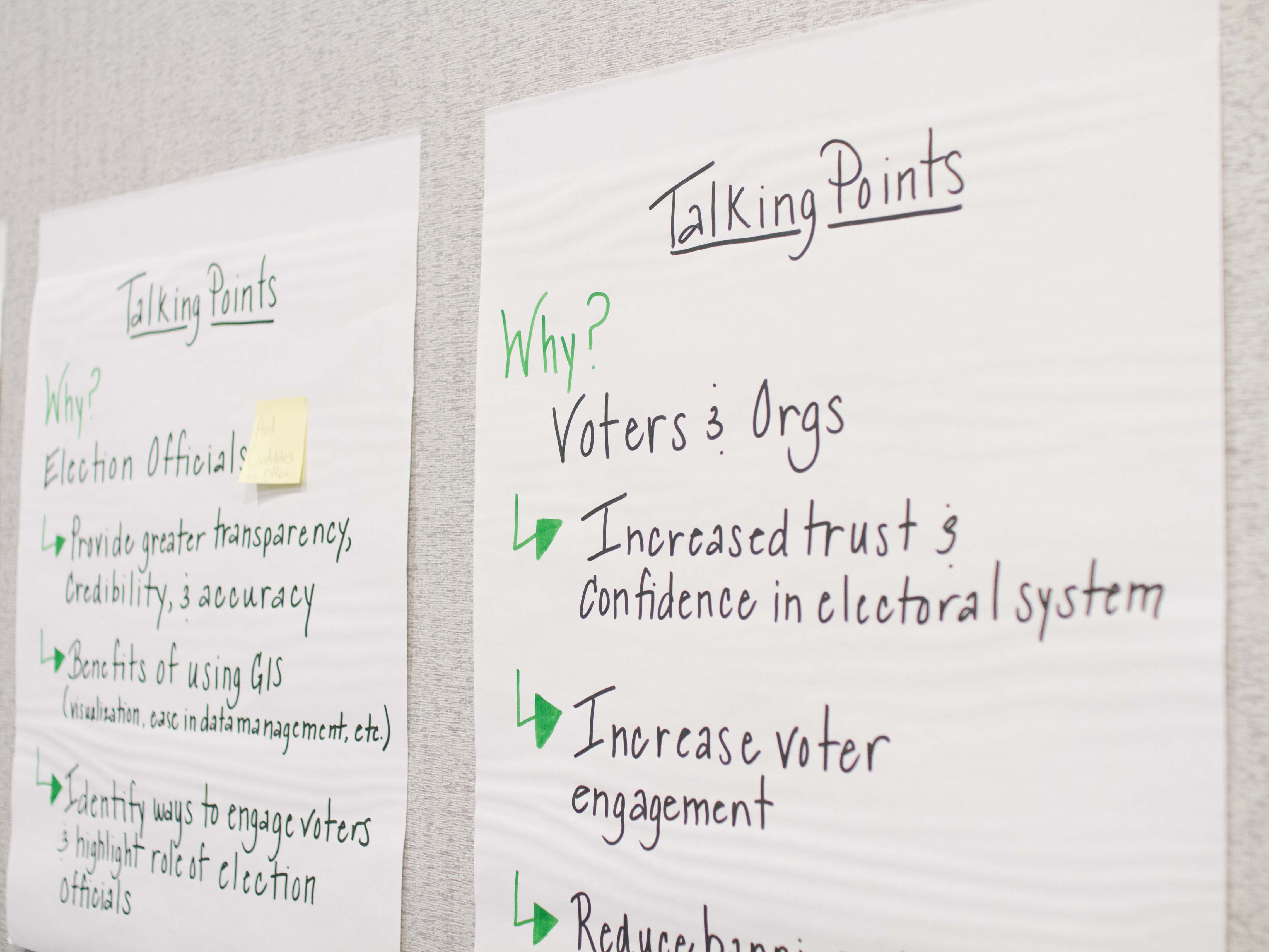
Midyear Meeting Takeaways for the Geo-Enabled Elections Project

NSGIC's Midyear Meeting - held last month in Salt Lake City - was an extremely productive time for the Geo-Enabled Elections project. Our steering group met in person for the first time, we held a four-hour workshop for conference participants, including state and federal government representatives, sponsors and other partners, and we ended the week with a well-attended plenary session.

Workshop Outcomes

Steering Group Workshop

The 13 members of the steering group met for a pre-conference workshop and identified a short list of best-practice areas to position a state for geo-enabling their elections system. These initial items are:
  • Statewide precinct layer with an associated maintenance process
  • Current statewide address info
  • Implementation options that give local control for locating address data
  • Standardization of terminology
  • System or process where GIS technologies and data are locally sourced and rolled up to the state
  • Contextual map data (for example, current aerial photography)

General Workshop

Read More

NSGIC Hiring Membership & Meetings Coordinator

Come work for NSGIC! We are hiring a new Membership & Meetings Coordinator who will focus on the areas of membership, events management and administration. Familiarity with the geospatial community and association experience are especially helpful. View the job posting for more information and to submit your resume.

Enhancing the Arizona Address Data Management Ecosystem: Midyear Meeting Presentation Highlight

With our Midyear Meeting fast approaching, we wanted to slow down and take a moment to highlight some of the presentations and panels that we are looking forward to. This week we are highlighting a presentation titled “Enhancing the Arizona Address Data Management Ecosystem," presented by Jenna Straface, Gene Trobia, Bo Guo, and Howard Ward on Tuesday, February 27. Read Jenna's presentation description below for a preview of the discussion content:

As one of the two original pilot states for the National Address Database (NAD) project, Arizona continues to build a statewide address management ecosystem. Key success factors include support of the Arizona Geographic Information Council (AGIC) and the Arizona State Land Department (ASLD), active state and local government collaboration, strategic public and private partnerships, participation in NSGIC's Address & Transportation Committee’s identification of national guidelines and best practices, and the adoption of new technology to improve data workflows and validate authoritative addresses.

The presenters will provide a brief overview of the Arizona Address Management Ecosystem and discuss several of its key components:

Read More

GIS in Computer Science Education: Midyear Meeting Panel Highlight

With our Midyear Meeting fast approaching, we wanted to slow down and take a moment to highlight some of the presentations and panels that we are looking forward to. The first panel we are highlighting is titled “GIS in Computer Science Education” and will be presented by Karen Rogers (WY) on Thursday, March 1. Read Karen’s statement below for a preview of the discussion content:

I was asked to be on the Computer Science Education Task Force in Wyoming, an effort led by the Department of Education. This diverse group has been meeting since September of 2017 to formulate strategies and ideas for integrating computer science (CS) in the classroom, as well as encouraging elected officials to pass legislation to formally acknowledge the importance of CS being taught to all grades in all schools.

Part of the discussion has centered on teaching computational thinking and the foundation of CS starting in elementary school so that all students have a basic fluency in CS by the time they enter middle school. From there, similar to electives like band or art, students can expand their learning and literacy in the subject and begin to specialize in the areas they find most interesting.

Read More

Geo-Enabled Election Project Gathers Momentum

When I joined the NSGIC staff a month ago as the geospatial programs manager, I learned very quickly that NSGIC is all about collaboration. This was great news to me because my focus in the next two years will be on the Geo-Enhanced Elections project, and it’s going to require a lot of collaboration!

GIS is relatively new to state elections implementations, though we are aware of several successful state implementations. When complete, a full GIS integration with a state election management system creates a map-based model of all the geographic features that interact in the election process and its results: district, precinct and ballot area boundaries; voter residence locations; polling places and drop-off locations; and address-based presentation of elected officials. The GIS digital model can significantly enhance accuracy, transparency, and efficiency of our representative government.

The Geo-Enabled Elections project fits within NSGIC’s “sweet spot” of working together to advance valuable state GIS capabilities through coordination, collaboration, communication and subject matter expertise support.

Read More

Transitioning...

Nobel Prize winner George Stigler said “a transition period is a period between two transition periods.” After almost 17 years with Utah’s Automated Geographic Reference Center (AGRC), five of them as director, I am about to transition into a new role with a new organization.

Next week, I’ll hand over my key card to the Utah AGRC office, take a two week break, and then head down the street to the Wasatch Front Regional Council, the metropolitan planning organization for the Salt Lake - Ogden metro area. My new job is leading WFRC's section of GIS, data science and transportation modeling staff, in supporting mid- and long-term planning for infrastructure projects, transit, economic development, land use and air quality.

This change is bittersweet, for sure, for many reasons - I am leaving a job that I’ve loved and found fulfilling, with an outstanding team and colleagues across state and local government - and also because I will be passing along Utah's NSGIC State Rep torch (a la Minecraft) that has connected me to so much expertise and important personal and professional connections.

Read More

NSGIC Welcomes New Staff Members

NSGIC recently announced the addition of two new staff members to the team: Bronwyn Walls as Communications Coordinator and Jamie Chesser as Geospatial Programs Manager.

bronwyn headshot

Bronwyn Walls - Communications Coordinator

Read More

Mapping the Last Frontier: NOAA Award to Assist Alaska's Rural Coastal Communities

Alaska was recently selected to receive a 2018 - 2020 Digital Coast Fellowship. This award will provide long-term benefits for Alaskans who reside in coast communities, 80 percent of whom are vulnerable to extreme weather events and storm flooding.

The project - titled Bringing Alaska Coastal Communities Online to the Digital Coast: Coastal Flood Mapping for Rural Alaska - will build upon existing data, online mapping tools and partnerships to assist Alaska in responding to coastal flood hazards. This includes efforts to:

  • Develop a coastal flood forecast and catalog map tool

Read More

GIS Day Marks Reintroduction of Geospatial Data Act

This afternoon, the Geospatial Data Act (GDA) was introduced in the Senate by Senators Hatch (R-UT), Warner (D-VA), Heller (R-NV), Wyden (OR), Boozman (R-AR) and Klobuchar (D-MN) as S.2128 and in the House by Representatives Westerman (R-AR) and Moulton (D-MA) as H.R.4395. NSGIC has supported the GDA in a few different forms, it having been introduced in a previous Congress, as well as having undergone revisions since its last introduction. It has retained its critical core – developing a national spatial data infrastructure (NSDI) that will significantly improve government services for citizens across the country.

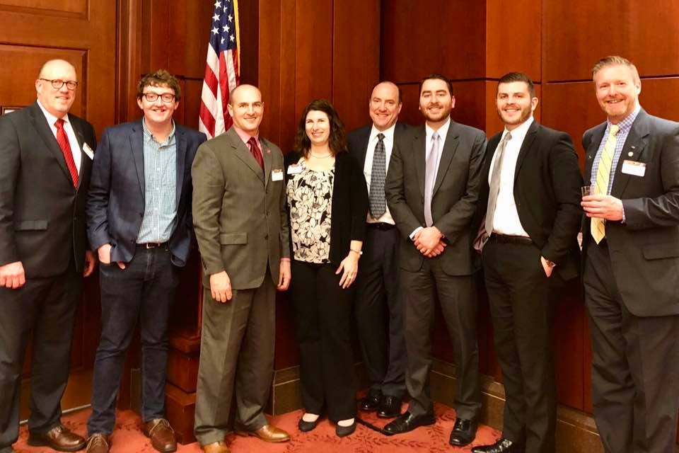
Working with partner organizations, we delivered a GDA support letter that included other well-respected national organizations and geospatial technology and services companies. It is the strongest showing of support for the GDA that has ever been garnered. I had the opportunity to join a few NSGIC colleagues – Cy Smith (OR), Shelby Johnson (AR), Dan Ross (MN) and our executive director, Molly Schar – for a Capitol Hill GIS Day reception we co-hosted with AAG and Esri. It was an excellent opportunity to speak with lawmakers and their staff members about why the GDA is so important, and it also gave us a chance to talk with the other nonprofit and corporate representatives in the room who are our partners in supporting this legislation. With transparent and coordinated advocacy efforts, we can leverage the momentum building in the geospatial community for this bipartisan, “good government” bill.

As I said in my remarks during the reception this afternoon, developing a national spatial data infrastructure is a concept that we have struggled with for the past 24 years – since the signing of Executive Order 12906 in 1993. The NSDI, as a concept, has mostly been an federal interagency pursuit, with little comparatively little consideration to harnessing the significant geospatial capabilities that state, tribe, regional or local governments, and the commercial sector have developed in the past two decades. The GDA codifies a strong multi-sector governance structure for NSDI strategy and activities, and it mandates Congressional oversight of federal geospatial expenditures. There are two specific provisions of this bill that NSGIC believes will be difference makers toward the achievement of a fully functional, and truly 'national' spatial data infrastructure.

Read More

Is the Future of NAIP Aerial Photography in Trouble?

Potential changes to the USDA's NAIP one-meter color aerial photography program were a hot topic of discussion at today's FGDC Coordination Group meeting.

In response to reduced funding, USDA is currently reevaluating the efficacy of the NAIP program. Reduced funding for NAIP is due to agency budget cuts, partially met commitments by federal partner agencies outside of USDA, and later-than-desired transfers of partner funding that require USDA to take on extra financial risk.

Accordingly, the NAIP acquisition contract renewals will be for one year only in 2018 and the NAIP flights are slated to move back to a three-year cycle. Notably, USDA is considering subscribing to a commercial imagery subscription starting as early as 2019, and has determined that a USDA-only COTS license would meet USDA needs while cutting their internal acquisition costs by 50% and improving resolution by 2x. USDA also stated that it was clear that it would only take a few agencies acquiring their own exclusive commercial imagery subscriptions before those costs exceeded the overall cost of NAIP.

Read More

USGS 3DEP Lidar Indexing for Continental US

Last month, the USGS released a 2 page fact sheet outlining their plans to align their 3DEP Lidar program with a standardized national grid. The proposed grid would guide the shape of proposed 3DEP grant projects (optional for 2018 but required in 2019) and, presumably, the distribution files for 3DEP data.

This new component of the 3DEP program has been encouraged by NSGIC members in recent years. The grid may prove useful as a framework for negotiating coverage and costs between adjacent project/interest areas. It is also likely the grid will help USGS facilitate 'infill' between larger gaps found between proposed projects and/or existing data.

Also of note, the US National Grid system, based on the military reference system, was given consideration but in the end was not selected. The logic seems solid on this for the reasons USGS cites, although it does mean that most projects will no longer have a true North-South orientation. (Chalk this up in the 'if no one's perfectly satisfied, you might have a good solution' category).

Read More