

Prepare: Redistricting Approaches!By Bert Granberg | March 29, 2021 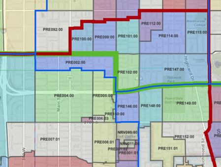
Really big decisions are about to be made in your state. Say what you want about the redistricting process, but the fact is, somebody’s going to have to put the results to work to run our future elections. And with that in mind, I've dusted off my list of observations from 10 years back, about what makes for the best set of boundaries from a standpoint of state election directors, local election clerks, and the GIOs and others supporting them with GIS. The observations I’m sharing are based on first-hand experience in 2011-12, watching the redistricting process from a safe distance, while preparing to support the use of the new districts. During this period, Utah was one of the first states to integrate GIS-based address locations, voting unit polygons (precincts and sub/splits), aerial photography, and parcel base maps into its statewide elections management system. In addition, the Utah Legislature deployed a 'build-your-own' redistricting plan webmap, another first. As a result, GIS was front and center on the redistricting stage, exposing new users to its power and broadening their appreciation for authoritative data and the precision of modern map technology. Oh, and keep in mind that just to make it more interesting this year, the Census Bureau is delaying its first 2020 census data product release -- the block-level redistricting files -- by 6 months. With the first glimpses of the 2020 count details not available until at least August 15, we are looking at a compressed redistricting process, and the local and state elections management work to implement new districts, into a few short, but hectic months. Here are five observations based on my experience a decade ago: Observation #1 - GIS as the Center of AttentionThis was the first time that high-precision GIS data was everywhere in a very public redistricting process. This meant many more eyes on the election boundaries, and as a result, more issues were detected and there was greater resolve to fix those issues. In particular, County Clerks were able to identify many small problem areas with the newly passed districts and were able to apply pressure for an unexpected round of updates after the plan had passed, necessitating passage of a second redistricting bill. Takeaway -- Using a tighter process to get the redistricting right the first time will be especially critical given the compressed schedule in 2021. Observation #2 - Local Boundaries MatterFor election management, some boundaries matter more than others. For example, you know that many local government offices (mayor, council person, assessor, sheriff) follow city or county boundaries. Portions of these jurisdictional boundaries do change occasionally through annexations and boundary agreements but large portions remain static over a decade or more. Keeping the local boundary GIS data current and actively considering them during the redistricting environment will make your County Clerks happy. And, participating in the Census Bureau's Boundary and Annexation Survey (BAS) at a statewide level will ensure that these boundaries are integrated, as much as possible, into future Census Bureau block geography used the next time redistricting comes around. There may be some misplaced local expectations that district and precinct boundaries will not change as a part of the redistricting process. This can be rooted in past experience, but there are no guarantees that it will happen again. As part of regular communication channels, elections officials should remind all those involved ahead of time that keeping existing boundaries in place is at best a lower priority, in formulating the new districts, and by extension - the new precincts. Everyone should be at-the-ready for possible changes. Takeaway -- There are a lot of good reasons, beyond redistricting, to require that local governments inform the statewide local boundaries steward whenever changes are made. If you haven't done so already, consider ramping up your state-level efforts to compile and sustain local boundaries. Observation #3 - Getting Deviation RightA sound Congressional redistricting plan should achieve a 'zero population deviation' goal between the districts. This means an equal population in each congressional district. This is because federal case law suggests that if your congressional district plan doesn't achieve a zero deviation and someone else's does -- say an advocacy group -- a judge may be inclined to rule that your plan can be struck in favor of a more population-balanced alternative. “One person, one vote” prevails. At least for the Congressional boundaries in your state. Getting to minimal deviation often means introducing some jagged edges between the congressional districts to swap census blocks in order to balance population counts. This can make for a few odd, head-scratching boundaries at a fine-grained neighborhood scale to say the least. At the state level, there is no similar case law, at least not nationally. Districts for state boundaries should be much smoother, unless...unless there's an unnecessary competition to achieve a similar very small deviation for these districts too. The smaller the deviation goal, the more jagged the districts and jagged districts present several problems for the County Clerks (see Observation #3 below). Takeaway -- Don't shoot for a zero or tiny deviation in population for non-Congressional districts. It's much harder, creates confounding problems and appearances, and by the time of 2022 elections, the 2020 population numbers will be 30 months old. A 2-10% deviation should be acceptable, as long as there are no apparent equity issues in play. Observation #4 Boundary Cross-PollinationIn most cases, there are at least 3 sets of statewide districts to be redrawn: Congressional, State Senate, and State House. And there may be others. In Utah, there are State Board of Education districts as well. A precinct boundary must be set along all of the state-level district boundaries. In other words, the boundaries of the 3 or more types of state offices define many of the precinct boundary components. Now imagine that you have developed State Senate and State House districts independently of each other and of the Congressional boundaries. That's a lot of constraints for the precinct boundaries to follow. And, if you haven't heeded the advice in Observation #3 above, you've got lots of jagged precinct boundaries that, when overlaid, form very small precincts. That's a problem. Since precincts are the reporting unit for election results, very small precincts of a block or smaller can infringe on the secrecy of the ballot. Takeaway -- Ideally, the redistricting process for state-level offices should consider the other boundaries that are being redrawn for other state office districts. This can be done hierarchically (Congressional boundaries get set first, then State Senate, etc). Or, it can be done by allowing for a few iterations between concurrent efforts wherein boundaries are 'tuned' before finalization. Observation #5 AddressesDo you have a serviceable state-level geocoding strategy? I'm not going to belabor this point, but I will say there are a lot of uses for authoritative street and address data related to implementing/assigning the new districts and voting unit boundaries. And that's just the tip of the iceberg. Getting a state-level geocoding strategy in place and agreed upon could be a huge coordination and money-saving win. While it's best to do this with authoritative data periodically rolled up from local address authorities, that is not a requirement as a commercial product might be the best solution in the near-term provided the quality is high and the costs reasonable and well-managed. However, before you shell out for a commercial product, check and see if there’s a Next Generation 9-1-1 master address dataset in your state that has matured enough to support the geocoding you need. On a related note beyond basic address finding, you can help the redistricting and re-precincting effort to avoid some common headaches if you can provide a 'boundary issue areas' GIS map layer to be used as a background. For example, it's in everyone's interest to avoid drawing boundary lines through mobile home parks and new apartment complexes. The addressing can be really complicated in these areas and often the Census Block lines don't respect the buildings or lots. Building footprint layers are also useful, and if nothing else, the 2019/20 building polygons open-sourced by Microsoft might be better than nothing. Takeaway -- There’s still no better time than the present to get GIS and addresses working for everyone in your state. Voter assignment and precinct/district auditing are two great reasons to support creating or updating your state's geocoding strategy. And, while you're at it, you might consider some additional 'bells and whistles' data layers meant to keep voting boundaries off of existing buildings or other difficult-to-discern types of properties. |