|
Next Generation 9-1-1 (NG9-1-1)
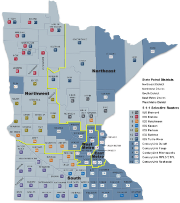
 NG9-1-1 is a ‘game changer’ for the 9-1-1 community because it will utilize GIS technology to deliver every 9-1-1 call -- mobile, VOIP, and landline alike -- to 9-1-1 public-safety answering point (PSAP) centers with precise geographic coordinates. Each state, or large region, implementing NG9-1-1 will need, at a minimum, complete, seamless, and standardized GIS data for its road and addressing systems and response jurisdictional boundaries (fire, law, medical, and the 9-1-1 centers themselves). Additional GIS data layers include: landmarks, campus buildings, highway mile-posting, cell towers, railroads, lakes, streams, and parks, just to name a few. NG9-1-1 is a ‘game changer’ for the 9-1-1 community because it will utilize GIS technology to deliver every 9-1-1 call -- mobile, VOIP, and landline alike -- to 9-1-1 public-safety answering point (PSAP) centers with precise geographic coordinates. Each state, or large region, implementing NG9-1-1 will need, at a minimum, complete, seamless, and standardized GIS data for its road and addressing systems and response jurisdictional boundaries (fire, law, medical, and the 9-1-1 centers themselves). Additional GIS data layers include: landmarks, campus buildings, highway mile-posting, cell towers, railroads, lakes, streams, and parks, just to name a few.
NSGIC recognized this fact in 2011 and created its NG9-1-1 Committee. This committee has members from many sectors of the 9-1-1 community. Its purpose is to educate the State GIOs and GIS coordinators on NG9-1-1 issues, and to coordinate with the 9-1-1 community to demonstrate how it can reduce its expenses through partnerships to develop seamless, large-area datasets. The State GIOs and GIS coordinators are expert at developing partnerships for data production. NSGIC entered into an memorandum of understanding (MOU) with the National Emergency Number Association (NENA) to ensure the free exchange of ideas between these two communities. It also focuses its advocacy efforts on how state GIS coordination can facilitate the roll-out of NG9-1-1.
NSGIC NG9-1-1-related resources and activities include:
- NSGIC's advocacy efforts in this area include membership and active participation in the NG911 Now Coalition, an MOU formalizing a two-way subject matter expertise exchange with NENA, member participation in NENA's standards develop process, and efforts to educate state leaders and stakeholders on the path forward for NG9-1-1, associated requirements and recommendations, and model state programs.
- A standing NG9-1-1 Committee to share information and stay on top of state and national activities, as well as new issues.
- NG9-1-1 Top Ten List for State Coordinators to help them know where they should start if they are not familiar with the 9-1-1 community.
- Working Smarter Together for NG 9-1-1 was created in concert with NENA and the National Alliance for Public Safety GIS Foundation (NAPSG) to identify a few overarching issues that are important to the 9-1-1 community and the emergency responder community.
- A consistent national survey intended for implementation on a state-by-state basis has been created by the NG9-1-1 Committee and was reviewed by NENA members.
Learn about NSGIC's NG9-1-1 Committee and available resources.
Emergency Response
 States are responsible for emergency management activities -- preparation, mitigation, response and recover -- related to large scale natural and man-made disasters. In addition to operating emergency operation centers, states are called on to coordinate and build mutual assistance relationships with neighboring states, regional government and federal agencies including FEMA and its parent organization, the U.S. Department of Homeland Security. GIS and related map technology are critical to planning and operations in this area, because of the extensive capabilities for sharing, integrating and visualizing information. States are responsible for emergency management activities -- preparation, mitigation, response and recover -- related to large scale natural and man-made disasters. In addition to operating emergency operation centers, states are called on to coordinate and build mutual assistance relationships with neighboring states, regional government and federal agencies including FEMA and its parent organization, the U.S. Department of Homeland Security. GIS and related map technology are critical to planning and operations in this area, because of the extensive capabilities for sharing, integrating and visualizing information.
Learn about NSGIC's Geospatial Preparedness Committee and available resources.
|
